
Prospection Methods
Archaeology applies various methods when it comes to the search for archaeological remains. Ideally, archaeological sites are detected using non-invasive prospecting methods, which can either identify unknown sites or reveal certain characteristic aspects of archaeological sites, such as architectural structures or funerary monuments.
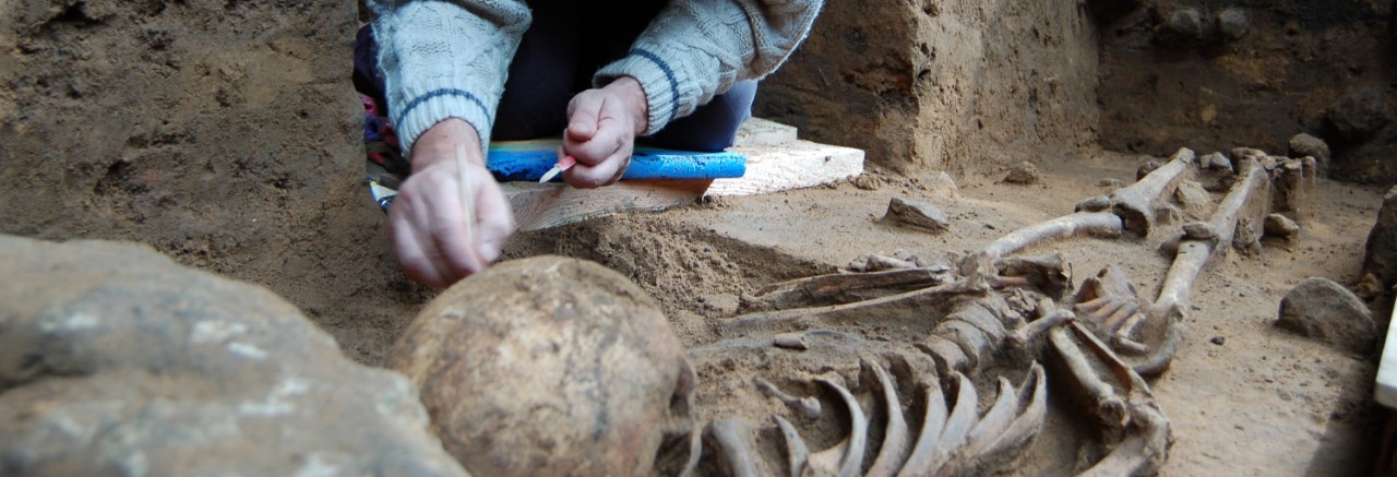
These non-invasive methods also come into play during preliminary studies for excavations. The archeological excavation, on the other hand, is a traditional archaeological method involving the controlled and documented destruction of the original archaeological site and is therefore a destructive method.
Fieldwalking
Fieldwalking involves systematically surveying an area of land, such as a freshly ploughed field, on foot. All archaeological evidence found on the surface (stone objects, pottery shards, slag, etc.) must be recorded and geolocated. This provides information on the chronology, purpose, and extent of an archaeological site.
Prospection by metal detector
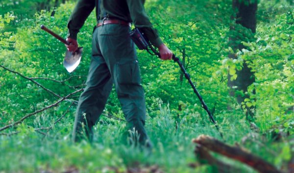
This type of prospection involves surveying the concerned area using a metal detector. The metal detector used by archaeologists is derived from the military mine detector.
It can detect all kinds of magnetic anomalies in soil and water left behind by human activity and can therefore pinpoint metal artifacts and locate yet unknown archaeological sites.
The metal detector can detect not only metals, but also burned structures such as hearths or furnaces.
During archaeological excavations, it enables metal objects to be identified in advance - without having to be torn out of their archaeological context immediately.
Please note that ministerial authorisation is required for the use of metal detectors in Luxembourg!
The public must obtain authorisation from the Ministry of Culture to use metal detectors to detect archaeological heritage. To apply for ministerial authorisation to use a metal detector (even on your own property), please follow the procedures explained in the metal detector authorisation application section.
Geophysical prospection
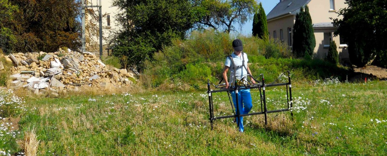
Geophysical prospection is a non-invasive survey method that involves scanning the ground by using measuring equipment to determine certain physical parameters. Ground anomalies are analysed, and archaeological structures identified. These results are then processed by specific softwares to produce a map of the preserved archaeological structures.
There are three types of geophysical prospection:
- Geomagnetic survey is carried out using a geomagnetometer: disturbances in the earth's magnetic field caused by archaeological structures (e.g. walls) are detected geomagnetically.
- The geoelectrical method identifies disturbances through variations in electrical resistivity.
- The georadar method is based on the reflection of radar waves sent into the ground.
Aerial survey
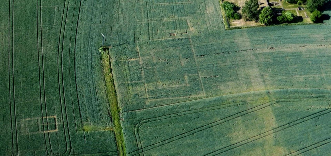
Aerial survey (or aerial photography) consists of spotting micro-relief shadows, crop growth anomalies, soil moisture or colour anomalies, corresponding to archaeological structures preserved in the soil. Archaeological interpretation of aerial photographs then enables the identification of archaeological structures such as burial mounds, buildings, ancient roadways, etc.
LIDAR-based survey
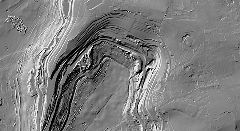
With LIDAR (Light Detection and Ranging), the area to be surveyed is flown over by a device equipped with a computer-assisted laser scanner. The light pulse sent out by the scanner is reflected by the ground, providing a 3D image of the terrain in question. Trees and other obstacles can be filtered out. In this way, archaeological structures such as burial mounds or fortifications can even be identified in a densely wooded area.